Bjørnøya, also known as Bear Island, is a remote and windswept island located in the Barents Sea, halfway between mainland Norway and the archipelago of Svalbard. Despite its isolation and harsh environment, it holds a significant place in the Arctic region’s geography, history, and mythology.
This forbidding yet fascinating island represents one of the most extreme inhabited locations on Earth, where human presence is limited to a small meteorological station staff. Its stark beauty and ecological importance make it a subject of continued scientific interest.
Location and Geography
Bjørnøya lies at approximately 74°30′N 19°00′E, covering an area of about 178 square kilometers. It is the southernmost island of the Arctic Svalbard archipelago and belongs to the Kingdom of Norway.
The island lies approximately 400 kilometers north of continental Norway and about 235 kilometers south of Spitsbergen, the largest island in the Svalbard Group. This strategic position places it at the crossroads of major Arctic shipping routes.
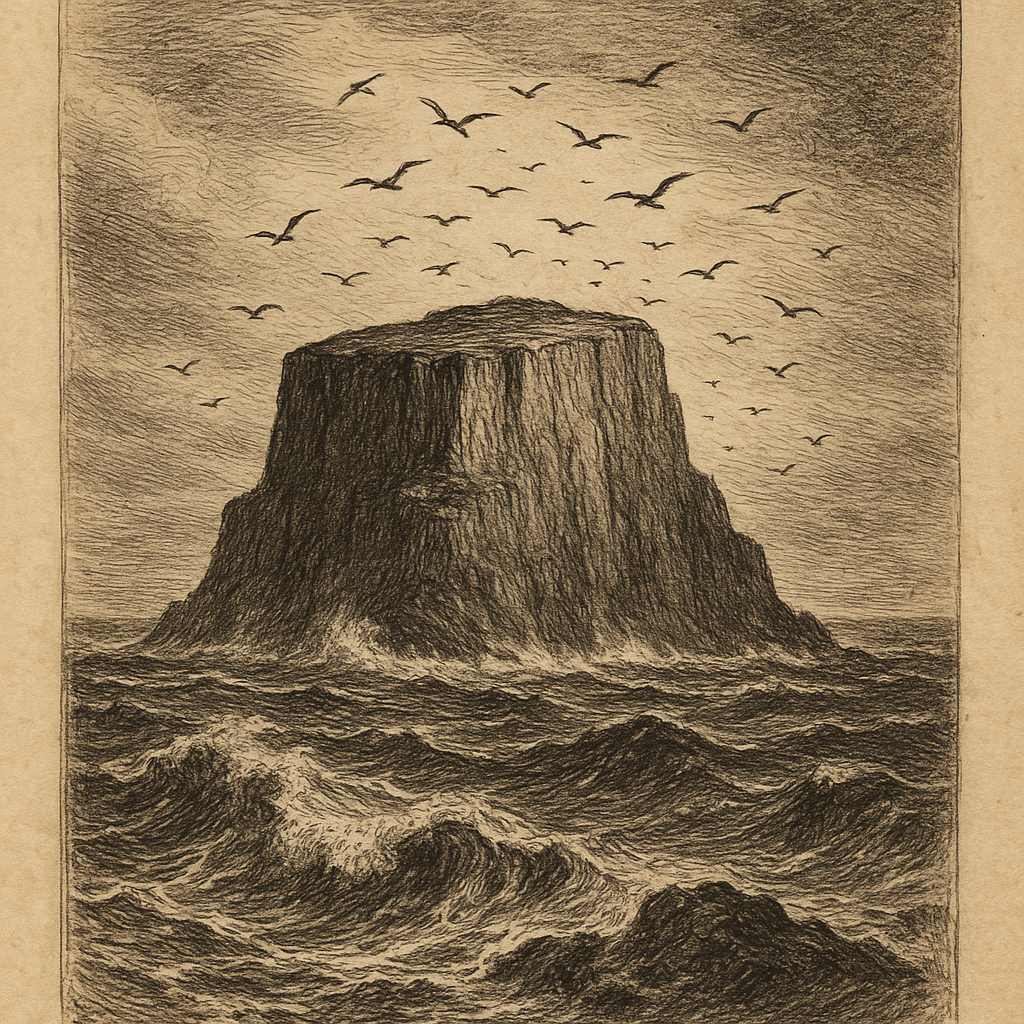
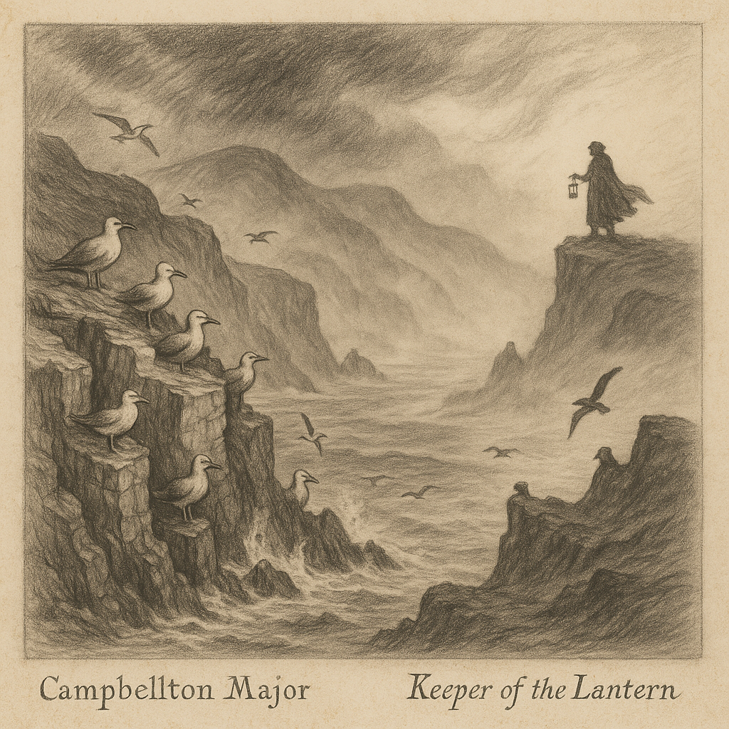
The island’s rugged coastline is mostly composed of steep cliffs and rocky outcrops, particularly on the western and southern shores. Fjords and inlets break up the coastline, creating natural harbors and nesting sites for thousands of seabirds.
The terrain is largely flat and barren, dominated by tundra vegetation, mosses, and lichen, with no trees present due to the extreme Arctic climate. The landscape presents an otherworldly appearance, particularly during the polar night when darkness prevails for months.
Geological Origin and Climate
Formed approximately 750 million years ago, Bjørnøya is geologically unique within the Svalbard archipelago. It includes layers of sedimentary rocks such as sandstone, shale, and limestone, representing a long tectonic and glacial history.
The island features fascinating geological formations, including karst landscapes and sea caves formed by centuries of erosion. These formations provide valuable insights into ancient geological processes and climate patterns.
The island has a cold maritime climate, heavily influenced by the surrounding Barents Sea. Temperatures rarely drop too far below freezing in winter due to maritime moderation, but strong winds and fog are frequent.
Summers are brief and cool, with average temperatures slightly above 5°C. The island receives low levels of precipitation year-round, mostly in the form of snow or drizzle. These harsh conditions have shaped every aspect of life on the island.
Wildlife and Biodiversity
Despite its barren appearance, Bjørnøya supports a rich wildlife population, particularly in terms of birdlife. It is recognized as an Important Bird Area (IBA) due to the significant colonies of seabirds that nest on its cliffs.
Species such as little auks, fulmars, kittiwakes, and guillemots can be found in large numbers. During the breeding season, the cliffs come alive with the cacophony of thousands of birds, creating one of the Arctic’s most spectacular natural phenomena.
Marine mammals, including seals and walruses, occasionally haul onto its shores, and polar bears are infrequent visitors—most likely drifting in on the ice from the north. These apex predators remind visitors of the wild nature of this remote outpost.
The cold, nutrient-rich waters surrounding the island are home to various Arctic and sub-Arctic fish, making it an important feeding ground in the region. The marine ecosystem supports the entire food chain, from plankton to large marine mammals.
Human Presence and History
Bjørnøya was first discovered in 1596 by Dutch explorers Willem Barentsz and Jacob van Heemskerk during their search for the Northeast Passage. They named it after sighting a swimming polar bear near the island.
Although its harsh climate has prevented permanent settlement, the island holds historical significance due to its strategic position along the Arctic shipping and whaling routes. Many ships stopped here during the height of Arctic exploration.
In the early 20th century, mining and radio operations were conducted here on a small scale. During World War II, its location made it an important outpost for monitoring enemy movements in Arctic waters.
Norway established a meteorological station on the island in 1932, which remains operational today. The station, manned year-round by a small rotating crew, is the island’s only permanent presence. These dedicated individuals maintain vital weather and climate monitoring equipment.
Interesting Facts About Bjørnøya
There are no natural freshwater lakes on Bjørnøya, but several small tarns and bogs provide water in the summer months. This limited freshwater availability has always been a challenge for any human presence on the island.
Despite its name, polar bears are rare visitors, and the original bear sighting by Barentsz was a one-off—most likely an Arctic traveler carried by drifting ice. The name has persisted nonetheless, adding to the island’s mystique.
The meteorological station operates communications and weather reporting that are crucial for Arctic navigation and research. Ships and aircraft rely on these reports for safe passage through the region.
The airstrip on Bjørnøya is one of the northernmost in Norway, used exclusively for servicing the meteorological station and emergency evacuations. Landing here requires exceptional skill due to frequently challenging weather conditions.
The island’s bird cliffs have been designated as a nature reserve and are strictly protected under Norwegian law. Radio and oceanographic measurements taken from Bjørnøya have contributed to long-term climate studies in the Arctic region.
Legends and Lore of Bjørnøya
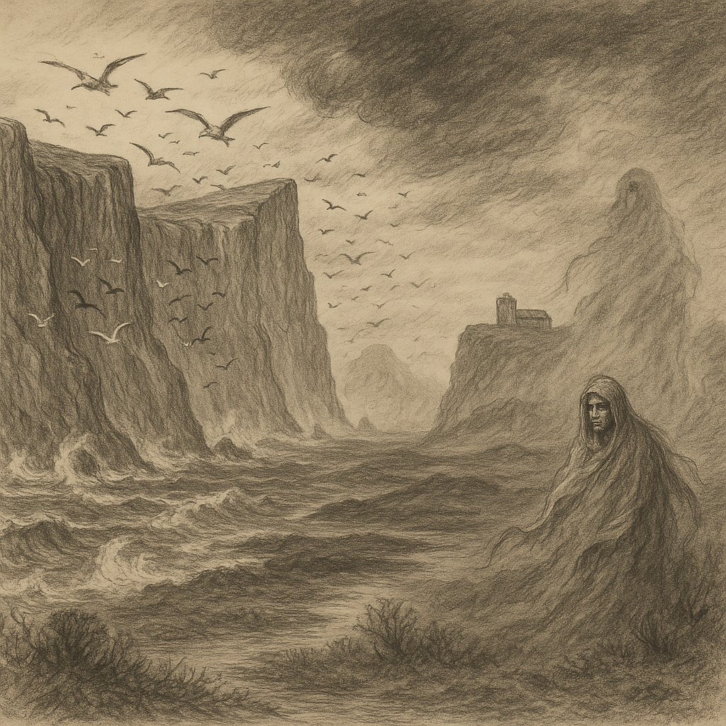
Given its isolation and dramatic landscape, Bjørnøya has long inspired tales of mystery and superstition among sailors and Arctic explorers. These stories have been passed down through generations of seafarers.
One legend says that the island is haunted by the souls of shipwrecked whalers who died in the brutal storms that rage through the Barents Sea. According to the story, their cries can still be heard among the cliffs during foggy nights, carried by the howling wind.
Another local maritime tale describes a “fog witch” believed to dwell in the boggy interior of the island. Sailors claimed she could summon storms to drive ships off course, punishing those who dared venture too close to the island’s shores without respect.
There is also a less sinister story of a “ghost radio” on the island. In the mid-20th century, radio operators reportedly picked up mysterious Morse code signals with no known origin, transmitting in patterns that made no sense. Some believe these were simply atmospheric phenomena, while others suggest they remain unexplained to this day.
Preservation and Access
Bjørnøya is strictly protected as part of the Svalbard Environmental Protection Act. Access to the island is limited to scientific researchers and personnel operating the weather and radio stations.
Any visitation must be approved by the Governor of Svalbard, and activities are closely monitored to prevent environmental disturbance. These regulations ensure that the island’s pristine ecosystems remain protected from human interference.
The island’s near-pristine condition and undisturbed ecosystems make it a valuable reference point for Arctic ecology and climate science. Conservation efforts emphasize minimal human impact and continued monitoring of both local and migratory species that depend on the island.
Conclusion
Bjørnøya stands as a testament to the stark beauty and ecological importance of Arctic environments. Its windswept landscapes, thriving birdlife, and deep-rooted legends make it one of the most intriguing islands in the northern hemisphere.
While largely hidden from the world, its significance in Arctic research, geological history, and folklore continues to endure, cloaked in mystery and icy allure. The island remains a symbol of nature’s resilience in Earth’s most extreme environments.