“`html
Location and Geography of Dagøya
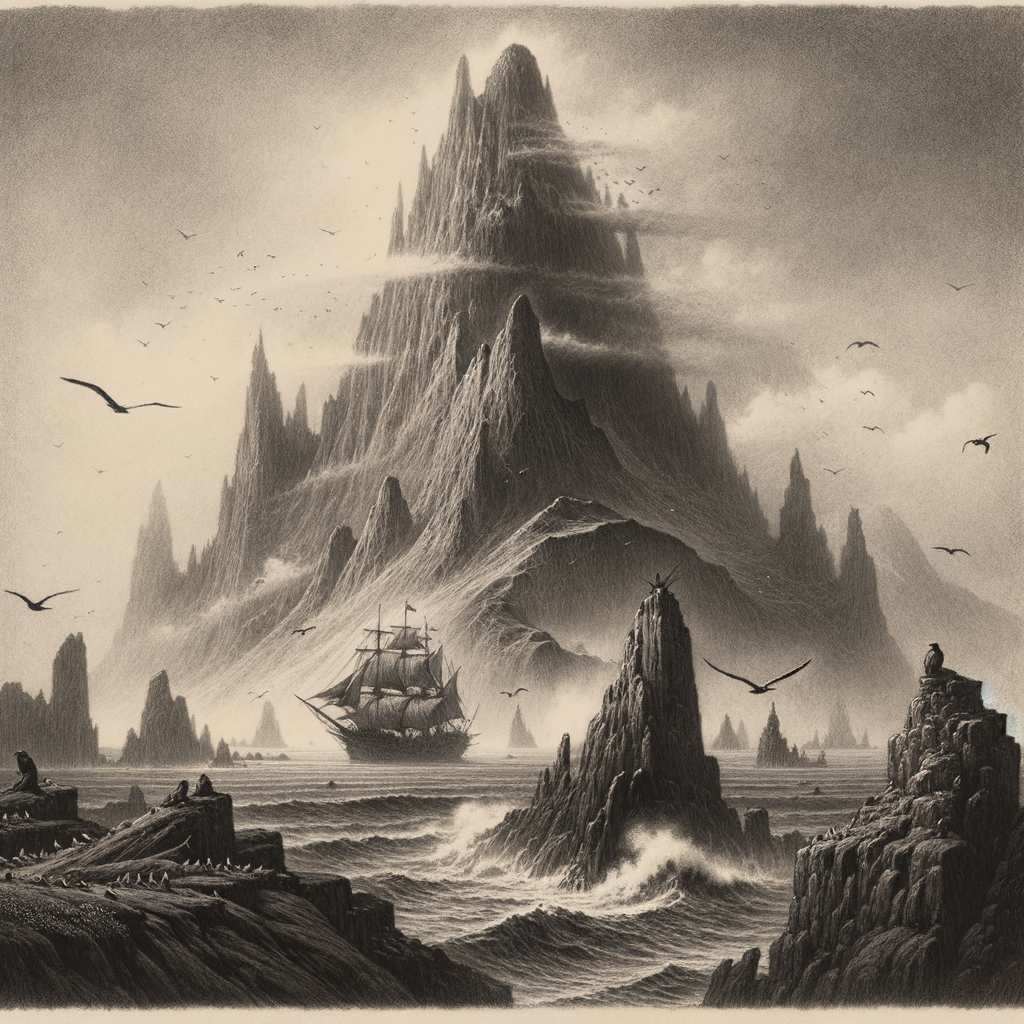
Dagøya is a remote and little-known island located in the frigid expanses of the Norwegian Sea, approximately 120 kilometers west of the Lofoten archipelago. The island is part of the Scandinavian Arctic Circle region, which places it in one of the most northerly settled zones in Europe. Covering an area of just 15.7 km², Dagøya remains uninhabited and rarely visited, standing solitary amid icy currents and dramatic oceanic weather. Its cliffs rise steeply from the sea, offering a rugged coastline and a windswept tundra landscape punctuated by moss, lichen, and hardy Arctic grasses.
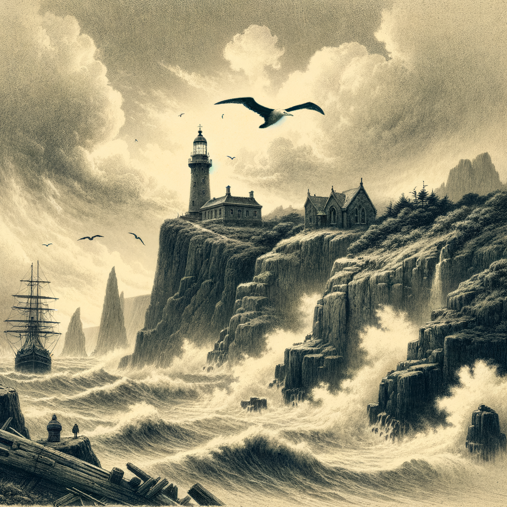
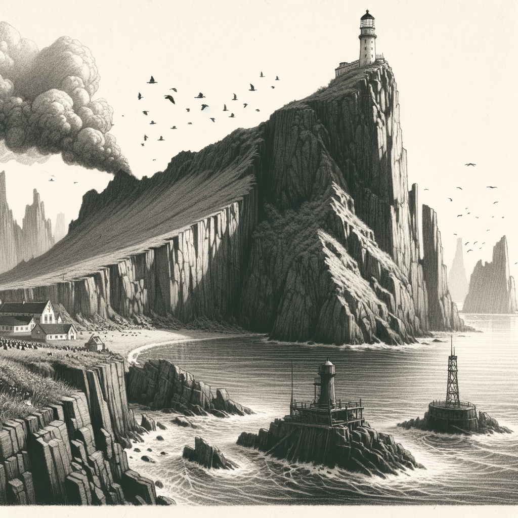
Though relatively small, Dagøya plays a unique role in marine navigation—its lighthouse, automated since the 1980s, has been a critical beacon for vessels navigating the often foggy and stormy region that connects the Norwegian Sea to the Greenland Sea.
Geology and Natural Features
Dagøya is of ancient glacial and volcanic origin. Geological studies indicate that the island was formed millions of years ago through a combination of underwater volcanic activity and the sculpting force of multiple ice ages. Jagged basalt formations encircle much of the island’s coast, while glacial erratics—large boulders transported by glaciers—are scattered inland.
The island’s highest point, at 312 meters above sea level, provides a sweeping view of the surrounding sea, where migrating whales and pods of orcas are often spotted. Inland, several freshwater tarns (small glacial lakes) provide breeding grounds for seabirds and Arctic foxes, one of the only land mammals found here. The island’s unique topography and wind erosion have created a natural amphitheater in the center—a hollowed, bowl-like plateau surrounded by sharply rising hills.
Dagøya is also occasionally disturbed by seismic tremors, a remnant of the tectonic tension along the Mid-Atlantic Ridge, which lies not far to the west.
Climate and Biodiversity
Due to its location within the Arctic Circle, Dagøya experiences long, dark winters and relatively cool but bright summers. Temperatures rarely rise above 10°C even in July, and winter lows can drop to –20°C with wind chill. Sea ice encroaches upon the island during the coldest months, though complete isolation by ice is rare due to shifting currents.
Despite the harsh climate, a surprising array of flora and fauna has adapted to life on the island. Plant species include Arctic willow, tufted saxifrage, and cloudberries. The cliffs and uplands are home to nesting kittiwakes, puffins, and guillemots—making Dagøya a prime destination for ornithologists during the short summer months.
In the surrounding waters, rich nutrient upwellings support plankton blooms, offering feeding grounds for Atlantic salmon, cod, and even humpback whales. Seals are also frequent visitors, using the island’s rocky beaches as resting points during migration.
Human History and Legends
The island has no permanent human population and limited documented history. However, Viking-era sagas hint that Dagøya was once used as a seasonal hunting and fishing outpost due to its strategic location between Norway and the open Arctic. Viking runes, carved into a coastal rock face and discovered in the early 20th century, remain the only archeological evidence of ancient visitation.
One particular legend says the island was known among Norse sailors as “Drageøy,” or Dragon Island. According to oral history recorded in northern Norwegian villages, a mythical sea serpent was believed to guard an underground river on Dagøya that glowed with blue fire. Some even believe the name “Dagøya” evolved from the old Norse “dagrøy,” meaning “day-smoke,” referring to the mysterious bluish mist that occasionally rises from the island’s center during the summer solstice.
Interesting Facts About Dagøya
– The island is home to one of the northernmost colonies of Atlantic puffins, with population estimates reaching over 12,000 during peak nesting season.
– During WWII, Dagøya was briefly occupied by German forces, who installed a radio monitoring station atop its summit. Rusted remains of the equipment still stand today, adding to the island’s eerie isolation.
– A phenomenon known as the “Midnight Halo” has been observed on Dagøya—a circular halo around the sun occurring near midnight during peak summer light, caused by high–altitude ice crystals reflecting the Arctic sun.
– The central hollow of Dagøya is a registered geoscientific monument due to its chilled lava flow patterns, which exhibit rare hexagonal formations.
Conservation and Access
Recognizing its ecological value and historical uniqueness, the Norwegian government has designated Dagøya and its surrounding waters as a protected marine nature reserve. The island is strictly off-limits to the general public without a special permit issued by the Directorate for Nature Management.
Scientific expeditions, mainly consisting of marine biologists, climatologists, and ornithologists, are the only regular visitors to the island. Access is typically granted only during July and August, when weather conditions allow for brief landings by helicopter or small boats.
Efforts are currently underway to monitor and mitigate any residual pollutants from the WWII-era installation, though levels today are considered minimal. Strict guidelines exist to ensure invasive species are not introduced, and all researchers must undergo decontamination protocols before landing.
Dagøya remains one of the few Arctic islands that has retained its primal character: untouched, enigmatic, and drawing in those who seek nature at its most sublime.