Far from any coast, the ocean seems to run on without end. Then, here and there, it breaks white over a single rock: the summit of a drowned volcano, a pinnacle streaked with guano, a reef that shows itself only when the tide goes out. These are the rocks in the middle of the ocean. Most of them cover no more than a few hectares, far too little to appear on an ordinary world map, which paints the whole ocean blue.
They have wrecked ships, sat in the wrong place on charts and been climbed by only a handful of people. One was found by a ship that ran onto it at night, and several saw their first known landing only in the age of the helicopter. The map below shows the rocks described here; where Remote Islands has a full article, the name links to it.
Atlantic Ocean: from Rockall to the Shag Rocks
1. Rockall
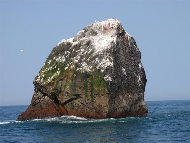
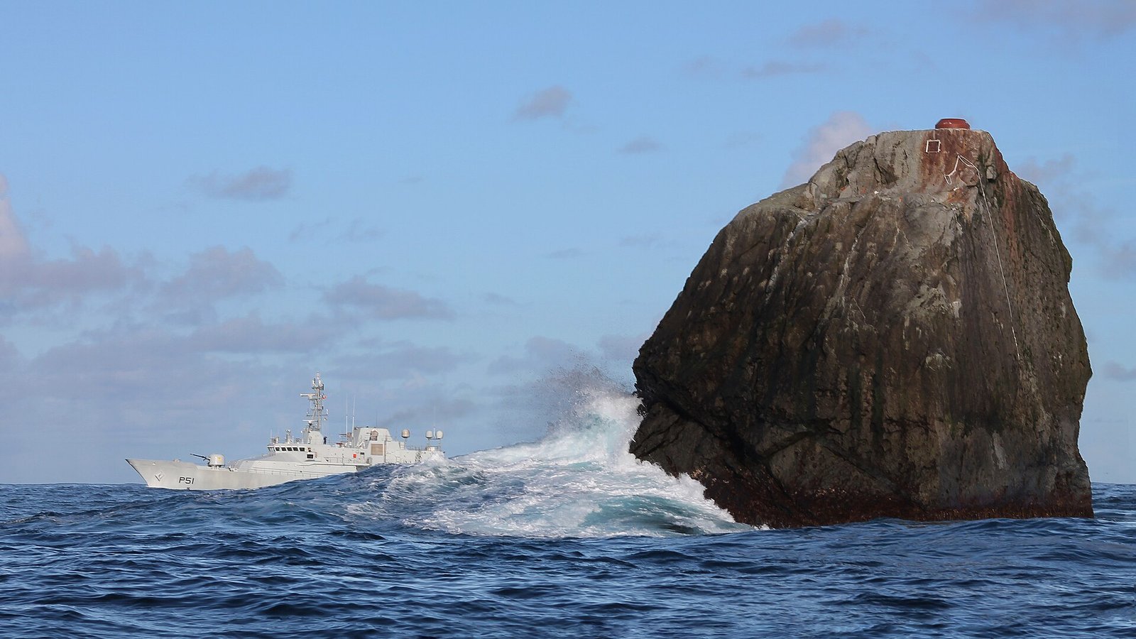
Rockall is a granite islet in the North Atlantic, 17.15 m high and about 25 m wide at its base. Its nearest land is the St Kilda archipelago, about 300 km to the east. A boat party from the frigate HMS Endymion made the first documented landing in 1811, and by July 2025 the Rockall Club counted only 146 people known to have landed on it. In 1904 the Danish ship Norge foundered in fog on Hasselwood Rock, 200 m to the north, with the loss of more than 635 of her 750 passengers.
2. Saint Peter and Saint Paul Archipelago
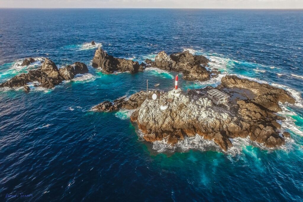
Fifteen small islets and rocks break the surface of the equatorial Atlantic here, 940 km from the coast of Brazil and 625 km from the islands of Fernando de Noronha. They were found by accident on 20 April 1511, when a Portuguese caravel, the Saint Peter, ran onto them at night; her consort, the Saint Paul, rescued the crew, and the rocks took both names. Charles Darwin visited them from HMS Beagle in 1832. Since 1998 the Brazilian Navy has kept a research station here, staffed by four researchers who are relieved every 15 days.
3. Martim Vaz
Some 49 km east of Trindade, itself 1,100 km off the coast of Brazil, the Martim Vaz islets rise from the South Atlantic. Together they cover about 0.3 km²; the largest, Ilha da Racha, is 175 m high, and beside it stands Rochedo da Agulha, the Needle Rock, a round rock 60 m tall. The Portuguese navigator Estêvão da Gama discovered the group in 1502. The group has its own article: Trindade and Martim Vaz.
4. Shag Rocks
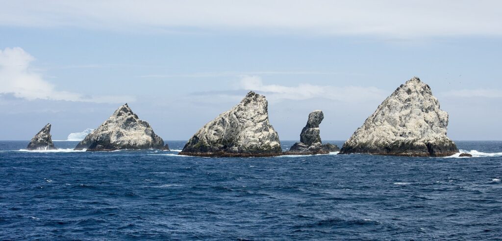
Six small islets 240 km west of South Georgia, the Shag Rocks rise to 75 m and cover less than 20 hectares. Nothing much grows on them; they are covered with the guano of South Georgia shags, prions and wandering albatrosses. The Spanish ship Aurora found them in 1762, and they were first named the Aurora Islands. The first known landing came only in 1956, when a geologist was lowered from a helicopter to collect rock samples.
Pacific Ocean: pinnacles, sunken atolls and a split rock
5. Ball’s Pyramid
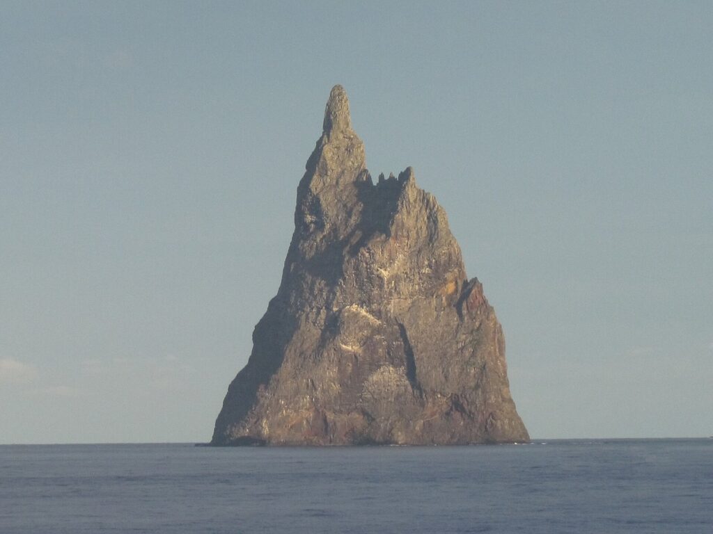
About 20 km southeast of Lord Howe Island, between Australia and New Zealand, Ball’s Pyramid stands 572 m high, 1,100 m long and only 300 m across, the tallest volcanic stack in the world. Lieutenant Henry Lidgbird Ball reported it in 1788. In 2001 a team of entomologists and conservationists found, under a single shrub on its slopes, a small population of the Lord Howe Island stick insect, believed extinct since 1920.
6. L’Esperance Rock
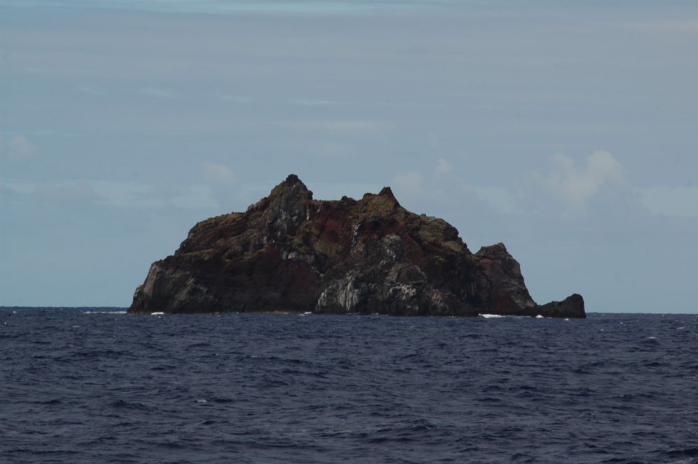
The southernmost of the Kermadec Islands, north of New Zealand, L’Esperance Rock is 250 m across and rises to 70 m. It stands 80 km south of Curtis Island, and with the rest of the Kermadecs it is recognized by BirdLife International as an Important Bird Area for nesting seabirds.
7. Minerva Reefs
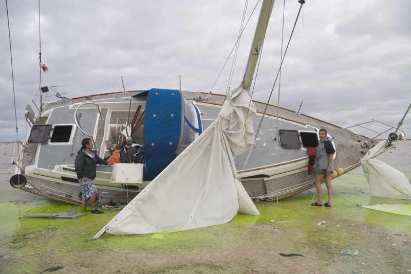
The Minerva Reefs, 485 km southwest of Tonga’s Tongatapu group, are two drowned atolls that barely break the surface; a small sand bar is awash at high tide. They keep the name of the whaler Minerva, wrecked here in 1829; the brig Rosalia had already been lost on them in 1807. In 1972 American libertarians declared a ‘Republic of Minerva’ on the reefs, and within months Tonga raised its flag over them.
8. Kingman Reef
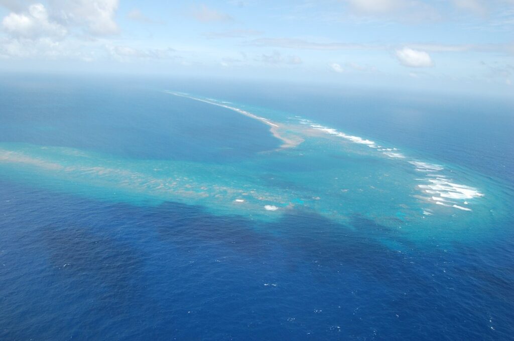
Kingman Reef, roughly halfway between Hawaii and American Samoa, is a largely submerged atoll with almost no land: small spits of coral rubble and giant clam shells, whose highest point is less than 1.5 m above the sea and wet or awash most of the time. Its nearest neighbor, Palmyra Atoll, is about 70 km away. Captain Edmund Fanning of the Betsey discovered it in 1798.
9. Gardner Pinnacles
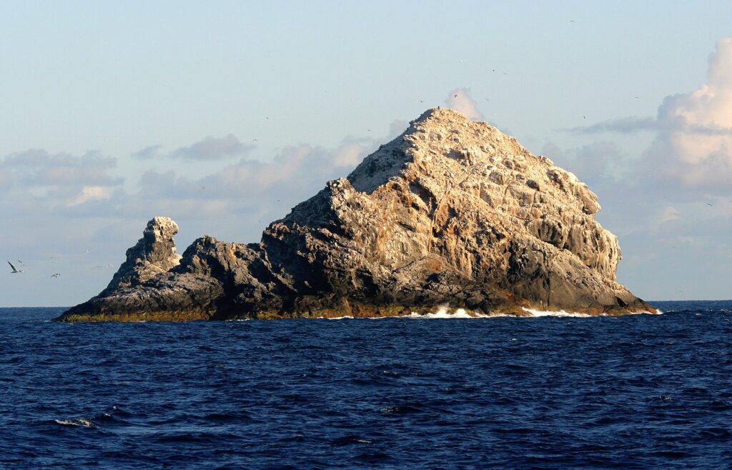
Two volcanic pinnacles in the Northwestern Hawaiian Islands, the Gardner Pinnacles cover just 2.4 hectares and rise to 52 m. They are all that shows above water of Pūhāhonu, described by researchers as the largest shield volcano on Earth, 174 km from French Frigate Shoals. More than a dozen species of birds have been seen here, and their guano gives the rock a whitish look. The whaler Maro discovered them in 1820.
10. Rocas Alijos
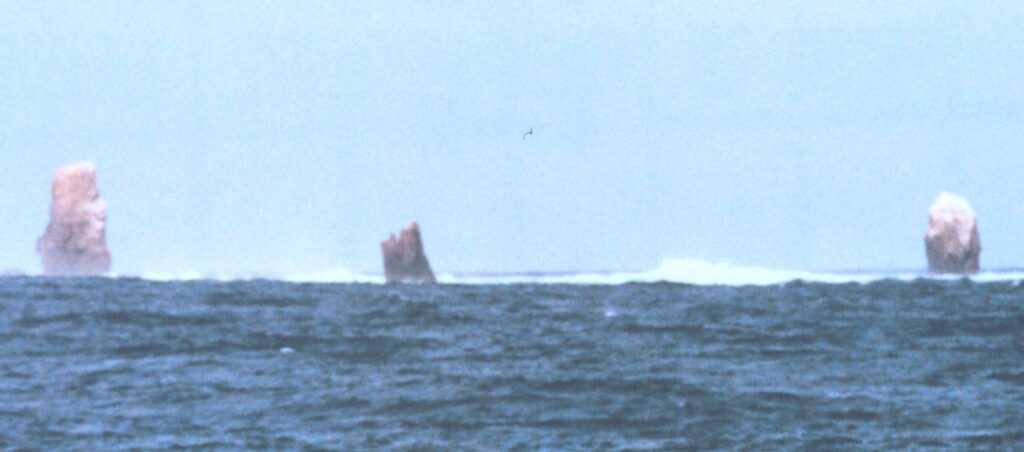
About 300 km off Baja California, the Rocas Alijos are three main rocks and a scatter of smaller ones, together covering only 1.2 hectares. South Rock, the tallest, is 34 m high and only 14 m across; it was first climbed in 1990. The pirate John Clipperton left the first description of the rocks in 1704. Masked boobies and sooty terns nest on them.
11. Roca Partida
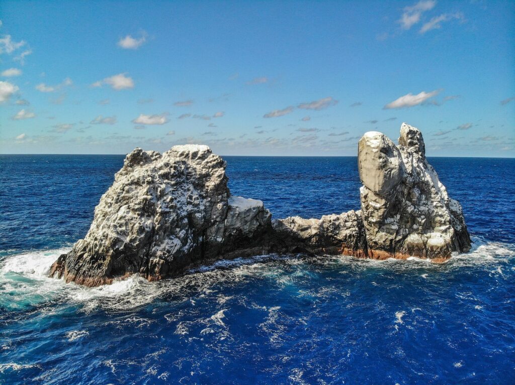
Roca Partida, the Split Rock of Mexico’s Revillagigedo Islands, is 100 m long and only 8 m wide, with two peaks that measured 25 and 34 m in 1953. It lies about 110 km from Socorro Island. A Spanish expedition under Ruy López de Villalobos reported it in 1542; Nazca and brown boobies breed on the bare rock today.
12. Salas y Gómez
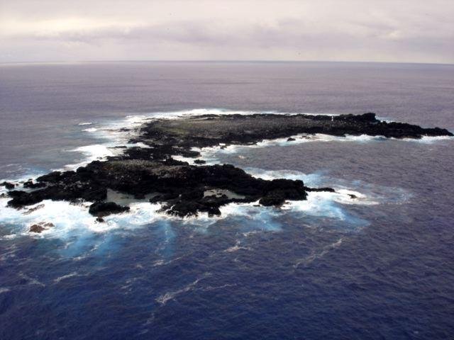
Salas y Gómez lies 391 km east-northeast of Easter Island: two bare rocks joined by a narrow neck, 15 hectares in all and 30 m at the highest point. There is no permanent fresh water, only a rain pool on which its seabirds depend, and landing is difficult in all but the calmest seas. The island is the summit of a mountain that rises about 3,500 m from the sea floor.
13. Lot’s Wife (Sōfu-gan)
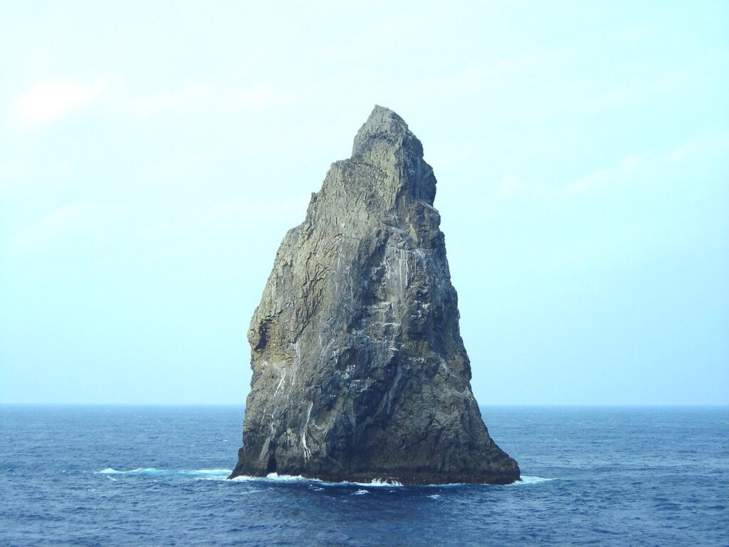
Some 650 km south of Tokyo, Lot’s Wife (Sōfu-gan) rises 99 m from the Philippine Sea, a basalt pillar only 84 by 56 m at the waterline. John Meares sighted it in 1788 and called it “the most marvellous thing” he had ever seen, naming it after the biblical figure turned into a pillar of salt. Its sheer sides make landing almost impossible; rock climbers succeeded in 1972 and again in 2003.
14. Okinotori
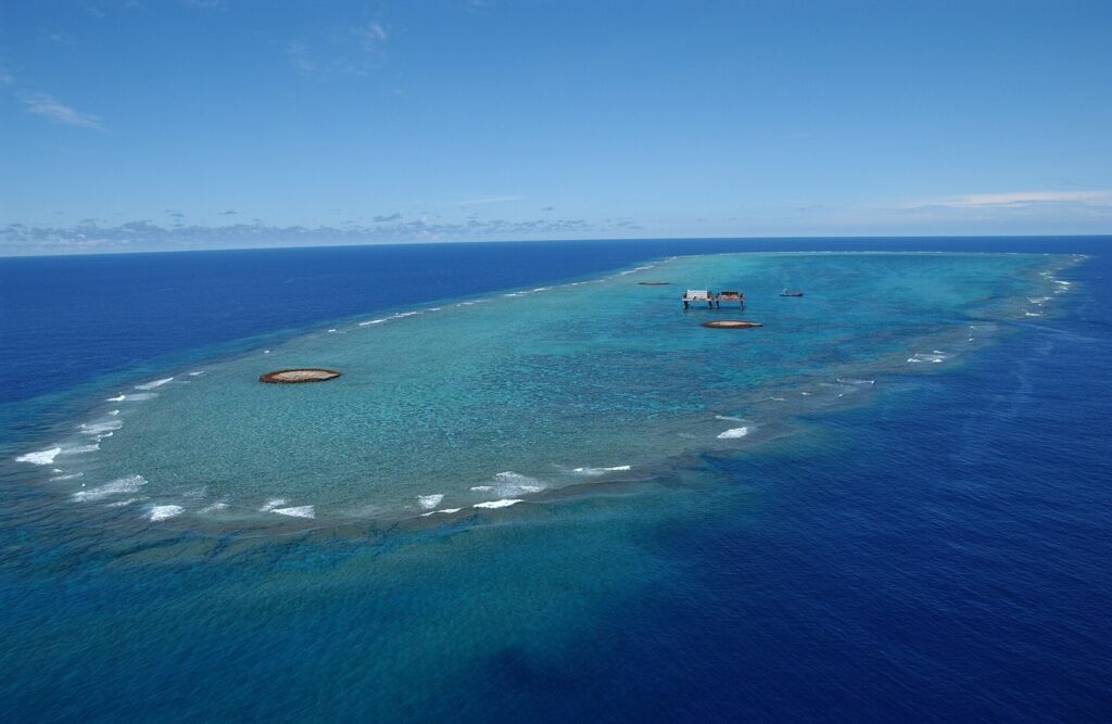
Okinotori, 1,740 km south of Tokyo, is a reef 4.5 km long that is almost entirely under water. At high tide only two tiny rocks show: one about the size of a small bedroom, rising 16 cm above the sea, the other the size of a twin bed, rising 7.4 cm. Japan has encased them in concrete; China, South Korea and Taiwan dispute that they count as an island under the law of the sea. Its first recorded name was Parece Vela, Spanish for ‘looks like a sail’.
Indian and Southern Oceans: reefs and ice-bound islets
15. Blenheim Reef
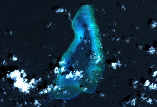
In the Chagos Archipelago of the Indian Ocean, Blenheim Reef stretches for almost 11 km, yet its islets are tiny: the largest, East Island, is not quite 200 m long. The ship Blenheim, which came upon it in 1836, gave the reef its name. Some 57 shipwrecks have been recorded around it, with an estimated 200 lives lost. In 2022 a Mauritian expedition spent fifteen days surveying it to learn whether any part stays above water at high tide.
16. Bishop and Clerk Islets
Some 30 km south of Macquarie Island, in the Southern Ocean, the Bishop and Clerk Islets cover 60 hectares; Bishop Islet itself is 3 hectares of rock rising to 45 m. Only three landings are known, all made by helicopter from ships, the first in 1965, the year a colony of black-browed albatrosses was found here.
17. Scott Island
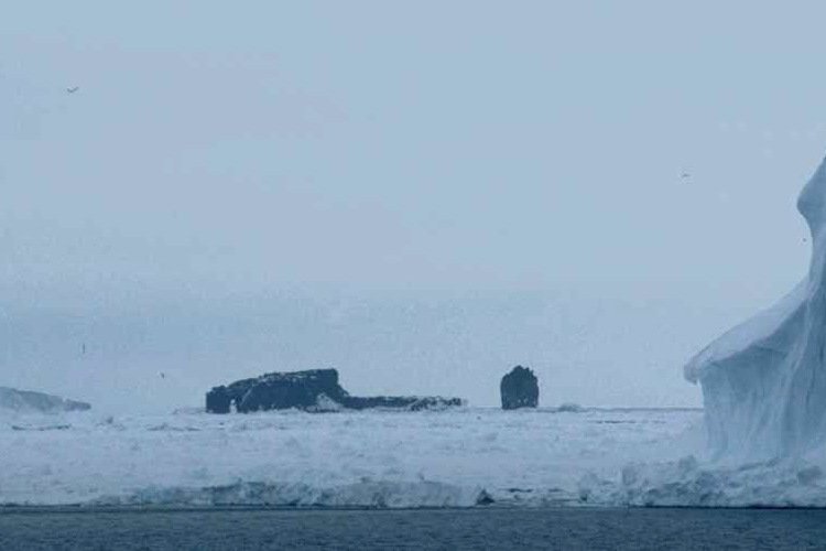
Scott Island lies in the Ross Sea, 505 km northeast of Cape Adare in Antarctica: 565 m long, 54 m high and 4 hectares in area, with Haggitt Pillar, a stack 62 m tall, standing 250 m to the west. Captain William Colbeck of the Morning, the relief ship for Robert Falcon Scott’s expedition, discovered it and landed there on Christmas Day 1902. In 2006 a mapping expedition found that it lies 2.3 km north of the position on the charts.
The tip of something larger
Most of these rocks are only the tips of far larger structures hidden below: seamounts, ridges and old volcanoes rising from the deep sea floor. Above the water they are little more than footholds for seabirds and markers for passing ships. They are still land, though, and they turn an empty blue map into one scattered with places.
Sources
- Wikipedia (2026): Ball’s Pyramid
- Wikipedia (2026): Bishop and Clerk Islets
- Wikipedia (2026): Blenheim Reef
- Wikipedia (2026): Gardner Pinnacles
- Wikipedia (2026): Kingman Reef
- Wikipedia (2026): L’Esperance Rock
- Wikipedia (2026): Lot’s Wife (crag)
- Wikipedia (2026): Minerva Reefs
- Wikipedia (2026): Okinotori
- Wikipedia (2026): Roca Partida
- Wikipedia (2026): Rocas Alijos
- Wikipedia (2026): Rockall
- Wikipedia (2026): Saint Peter and Saint Paul Archipelago
- Wikipedia (2026): Salas y Gómez Island
- Wikipedia (2026): Scott Island
- Wikipedia (2026): Shag Rocks (South Georgia)
- Wikipedia (2026): Trindade and Martim Vaz
- Natural Earth (public domain): land outlines for the map, naturalearthdata.com
- Distances to the nearest land for rocks with their own article: calculated by Remote Islands from Natural Earth and Wikidata, November 2026.
Featured image: Rockall with the Irish patrol vessel LÉ Róisín alongside. Photo: Irish Defence Forces, CC BY 2.0, via Wikimedia Commons.