Where the Indian Ocean rises into jungle and cliff
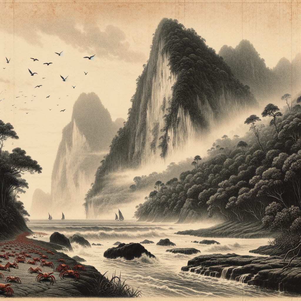
Long before its name suggested tinsel or feast days, Christmas Island was a dark mass in the eastern Indian Ocean, lifting abruptly from deep water far south of Java. It belongs politically to Australia, but geographically it feels set apart from almost everything: an isolated limestone cap over ancient volcanic rock, ringed in many places by sheer cliffs, with a plateau of dense tropical forest above and the sea breaking hard below. There are few easy landings. For sailors approaching in earlier centuries, that mattered as much as any map. The coast offered spectacle more readily than welcome.
The island was named on Christmas Day in 1643 by Captain William Mynors of the East India Company vessel Royal Mary, one of those moments in maritime history when a passing sighting fixed a place in the record long before people truly knew it. For more than two centuries after that, it remained mostly a name and a silhouette. It was too remote, too difficult to approach, and too lacking in obvious anchorage to draw immediate settlement. The impression it gave was of an elevated world closed in on itself: rainforest above, surf below, and seabirds moving through the heat.
That sense of separateness is not illusion. The land area is modest, but the vertical drama makes it feel larger and more severe. Terraces mark old uplifted reefs. Inland, caves and sinkholes open in the limestone. The climate is tropical, tempered by the surrounding ocean, with a wet season shaped by the northwest monsoon. Mist can cling to the plateau while the coast glitters in harsh light. It is a place where geology seems exposed and half-hidden at once, where the island’s structure tells a long story of uplift from the floor of the ocean.
A remote outcrop claimed, mined, and peopled
Human history arrived late and decisively. In the 1880s, naturalists and surveyors began to examine the island more closely, and with them came the discovery that would transform it: rich deposits of phosphate, formed over immense spans of time from accumulated seabird guano altered by tropical weathering. Britain annexed the island in 1888, and mining soon followed. What had been obscure became economically valuable.
The labor force that built this new life came largely from elsewhere. Chinese, Malay, and later other workers were brought to extract and process phosphate, and a permanent community took shape in a place that had no known Indigenous population before colonial occupation. Rail lines, quarries, company buildings, and loading facilities pressed against the old forest. The history is not the romantic loneliness of an untouched isle; it is the harder story of empire, resource hunger, and the creation of a society in isolation.
Sovereignty changed after the Second World War. The island had been occupied by Japanese forces from 1942 to 1945, a wartime chapter that left deep marks, and in 1958 it was transferred from British control to Australia. Yet its remoteness never ceased to define daily life. Almost everything had to come by sea or air. Economic fortunes rose and fell with phosphate. In the late twentieth and early twenty-first centuries, another layer of history altered the island’s image: it became known internationally as a site associated with Australia’s immigration detention system, a role that added a modern, political solitude to its older geographic one.
The red tide in the forest
If the island has a spectacle that belongs to no other place in quite the same way, it is the migration of its land crabs. Most famous is the red crab, Gecarcoidea natalis, whose numbers once reached extraordinary abundance and still define the island’s ecological identity. At the beginning of the wet season, usually around October or November, millions move from the forest toward the sea to breed. Roads close. Footpaths turn alive. The ground seems to shift color, as if the leaf litter itself had begun to flow.
It is one of the rare natural events that is both exuberant and faintly unsettling. The crabs climb over roots, pour down embankments, and crowd beaches below the cliffs. After mating and spawning, the adults return inland. The young begin life in the ocean before emerging and making their own tiny inland journey. Around this cycle, the island’s ecology has evolved in unusual ways. Land crabs are major consumers of leaf litter and seedlings; they shape the forest floor itself.
Yet even here isolation has not meant safety. The accidental introduction of the yellow crazy ant, Anoplolepis gracilipes, caused catastrophic impacts in some forest areas, killing vast numbers of red crabs through chemical spraying with formic acid and disrupting ecological balance. Conservation efforts, including ant control programs and the protection of large areas within Christmas Island National Park, became urgent acts of rescue rather than abstract stewardship. The island’s celebrated richness turned out to be fragile.
Its birdlife is equally distinctive. Endemic species and subspecies evolved here in long separation, among them the Christmas Island frigatebird, Fregata andrewsi, and the golden bosun, the local form of the white-tailed tropicbird. Seabirds wheel over cliffs and nest in forested edges; beneath them, rainforest covers much of the plateau with a density that can make the interior feel older than the settlement on its margins. In the nineteenth century, Charles W. Andrews of the British Museum visited and documented the island’s natural history, leaving one of the earliest detailed scientific portraits of this isolated ecosystem.
An island that keeps its distance
There are inhabited islands that feel busy even when quiet. This is not one of them. Even with a resident community, much of the place remains wrapped in a kind of deliberate silence: surf striking limestone, wind through canopy, the abrupt cry of seabirds, rain arriving with tropical force. The cliffs still make landing difficult. The forest still gives the impression of withholding something. Seen from offshore, the island looks less like a gentle tropical refuge than a fortress of uplifted reef and shadowed green.
Perhaps that is why it lingers in the imagination. Its history is not empty, but layered: a passing name in a ship’s log, a phosphate frontier, a wartime outpost, a biological wonder, a contested modern symbol. Few islands carry so clear a sense of being both connected to global systems and profoundly apart from them. In the end, what remains most memorable is not simply remoteness on a map, but the feeling of a place that rose from the ocean and never entirely surrendered its self-containment—a high, rain-dark world at the edge of familiar routes, still defined by cliffs, crabs, and distance.