Macquarie Island is a unique natural treasure located in the Southern Pacific Ocean. The island is renowned for its remoteness, rich wildlife, and exceptional geological significance. It is the only place in the world where rocks from the seabed are thrust above the ocean’s surface. Home to thousands of seals, penguins, and other animals, Macquarie Island is a UNESCO World Heritage Site and a popular destination for scientists and adventurers alike.
 History of the Island
Macquarie Island was discovered in 1810 by Captain Frederick Hasselborough, the same whaler who also discovered Campbell Island that same year. He named the island after Lachlan Macquarie, the Governor of New South Wales. During the 19th century, the island became an important site for seal hunting, which severely depleted their populations, mirroring the devastation seen across subantarctic islands like South Georgia. In the 20th century, attention shifted to the exploitation of penguins for oil, causing further ecological damage.
In 1911, the first research station was established during the Australasian Antarctic Expedition led by Douglas Mawson. This station primarily conducted meteorological and geological observations. Since then, Macquarie Island has become a hub for scientific research, though no permanent civilian settlement has ever been established.
Current Inhabitants
Today, the island is inhabited solely by scientists and technical staff of the Australian Antarctic Division’s research station, which operates year-round. The number of residents varies between 20 and 40, depending on the season. Researchers focus on studying climate, biology, and ecosystems. Civilian settlement is prohibited, ensuring the preservation of the island’s unique environment.
Geography of the Island
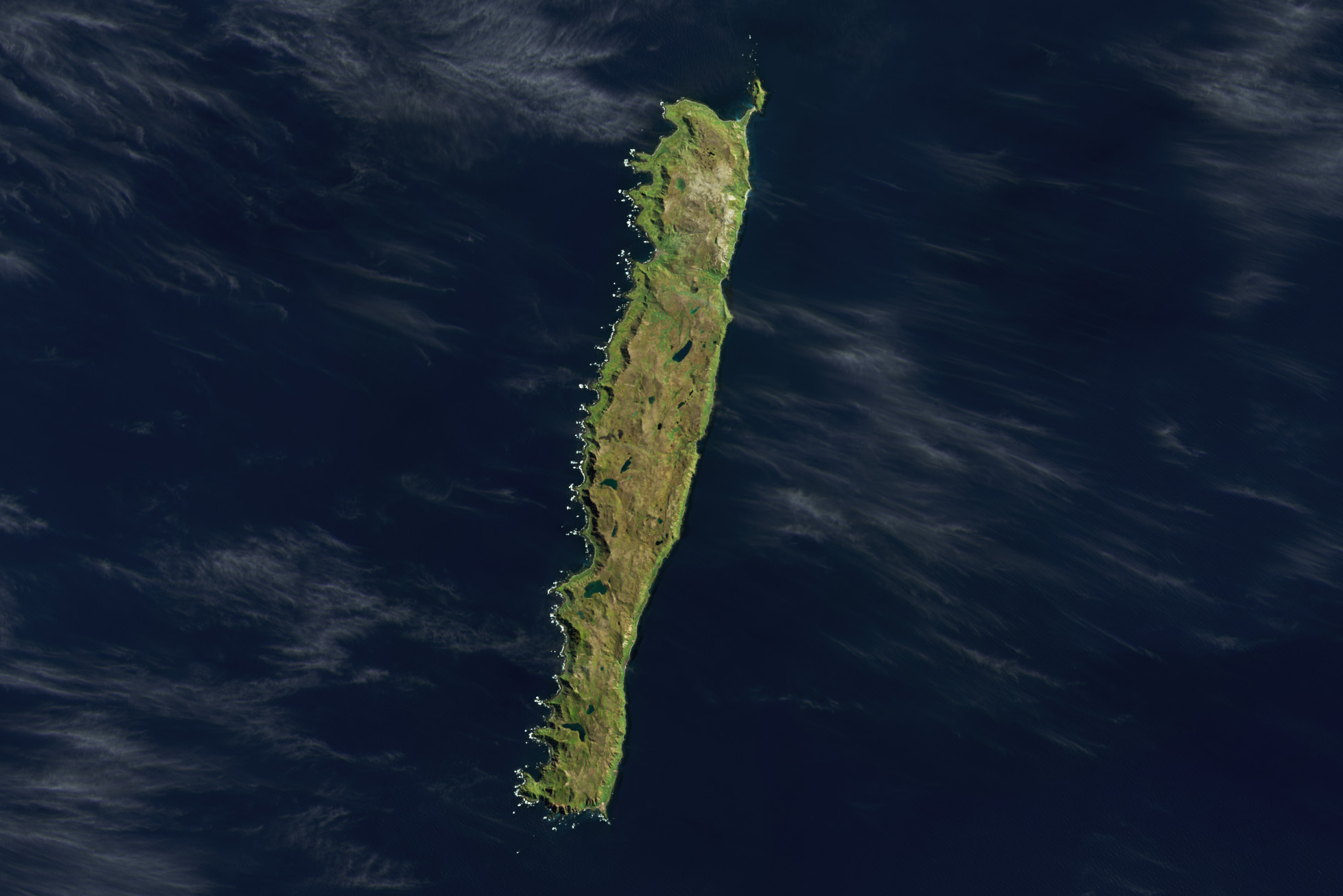
Macquarie Island is located roughly halfway between Australia and Antarctica in the Southern Pacific. It covers an area of 128 km², stretching about 34 km in length and no more than 5 km in width. The nearest landmass is New Zealand, approximately 1,500 km to the north, and Antarctica, about 1,300 km to the south. Geologically, the island is exceptional as part of an ocean ridge where deep-sea rocks are exposed at the surface. This phenomenon makes it a significant site for scientific research.
Flora and Fauna
The island is famed for its abundant wildlife. It hosts colonies of royal, yellow-eyed, and other penguin species. Seals and elephant seals frequent the island for feeding and breeding. Macquarie Island is also a critical stopover for seabirds, such as albatrosses.
The flora, shaped by the harsh climate, consists mainly of mosses, lichens, and hardy grasses. Introduced species such as cats and rabbits once severely disrupted the ecosystem. However, intensive eradication efforts have successfully restored the natural balance.
Macquarie Island is a fascinating example of natural resilience and beauty. Thanks to scientific research and strict protection measures, this unique ecosystem can be preserved for future generations.
 History of the Island