Rangiroa – The Vast Atoll in the Heart of the South Pacific
Rangiroa, often translated as “immense sky” in the local Tahitian language, is one of the largest atolls in the world and a remote treasure of French Polynesia. Located in the Tuamotu Archipelago, it lies roughly 355 kilometers northeast of Tahiti and captivates with its massive lagoon, abundant marine biodiversity, and fascinating cultural lore.
Geographical Marvel of the South Pacific
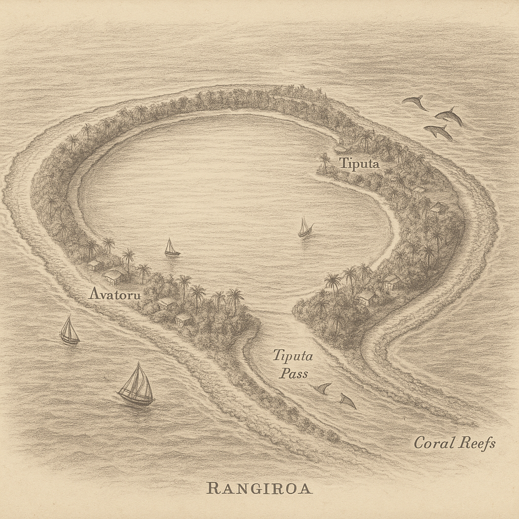
Rangiroa is not a typical island but a coral atoll formed over millennia atop a submerged volcanic mountain. The atoll stretches approximately 80 kilometers in length and 32 kilometers across, encircling a lagoon so vast that it is often mistaken for an inland sea. With over 240 tiny islets, or motus, surrounding the lagoon, Rangiroa is larger in size than the entire island of Tahiti.
Despite its immense size, the landmass of Rangiroa is minimal, consisting mainly of low-lying strips of coral and sand. The two main villages, Tiputa and Avatoru, are located on two adjacent motus near the atoll’s northwestern edge. These settlements serve as key access points for visitors and offer insight into daily life on such a removed and sea-dominated landform.
Volcanic Origins and Coral Legacy
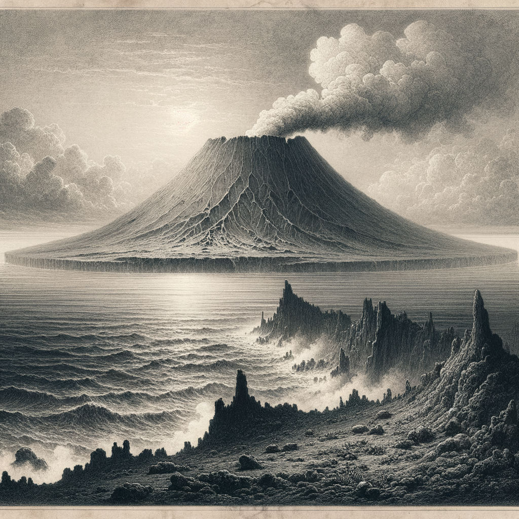
Rangiroa’s history begins deep in the ocean’s past—like many atolls, it originated from an underwater volcano. Over time, as the volcano went extinct and began to sink, coral reefs rose around its fading caldera. Eventually, the central volcanic peak vanished below the surface, leaving a ring of coral surrounding a vast, shallow lagoon.
Driven by the rhythms of the ocean tides, two main passes—Tiputa and Avatoru—cut through the coral ring, allowing seawater and marine life to flow between the lagoon and the open ocean. These passes are vital to both ecological balance and human activity, particularly diving and fishing, which are integral to Rangiroa’s economy.
A Subtropical Climate and Unique Biodiversity
Rangiroa enjoys a tropical climate with a relatively stable temperature year-round, ranging between 24°C and 31°C. Annual rainfall averages around 1,500 mm, occurring mostly during the austral summer months from November to March. Despite the arid nature of the soil, coconut palms, pandanus, and a few hardy fruit-bearing trees flourish on the motus.
What truly sets Rangiroa apart, however, is its dazzling marine environment. The lagoon harbors an extraordinary array of life, from countless species of reef fish to coral gardens and pelagic visitors such as manta rays, dolphins, and even hammerhead sharks. Whale watching is possible in certain seasons, and green turtles often nest on the remote beaches of the atoll.
The Human Story and Cultural Heritage
Though home to around 2,500 inhabitants, Rangiroa still feels like a secluded escape. The residents, mainly Polynesians of Tuamotuan descent, practice a vibrant culture deeply tied to the sea. Traditional fishing, coconut harvesting, and pearl farming are not only livelihoods but elements of cultural identity.
Black pearl farms dot the atoll’s lagoon, and Rangiroa is considered one of the leaders in French Polynesia’s pearl production. Visitors can tour these farms to learn about the meticulous process of pearl cultivation, an art that has been perfected over generations.
Legends of the Lagoon
Polynesian oral traditions are rich with mythology, and Rangiroa has its share of sacred tales. One particularly enduring legend tells of a demi-god named Maui who fished the islands of the Tuamotus from the sea. Rangiroa, known in legend as a celestial canoe, was moored in the sky before it drifted down to its present location. The lagoon’s shimmering surface is said to be the celestial ocean once inhabited by the gods.
Other stories tell of guardian spirits protecting the passes of Tiputa and Avatoru, once believed to be gateways between the worlds of the living and the dead. Locals still perform small rituals before venturing into the sea, a lingering nod to ancient reverence for Rangiroa’s powerful natural forces.
Noteworthy Facts about Rangiroa
– Rangiroa ranks as the second-largest atoll in the world by surface area enclosed by its reef.
– The lagoon is so large it can accommodate an entire island like Tahiti within its boundaries.
– The atoll was visited by famed marine explorer Jacques Cousteau, who declared its lagoon one of the most beautiful scuba diving sites in the world.
– Tiputa Pass is known for an exceptional phenomenon called the “shark wall,” a lineup of grey reef sharks often observed drifting lazily in the current.
– The atoll’s unique wine is one of few viticultural achievements in coral soil and is produced from vineyards located in the heart of the coral islets.
– Despite its remoteness, Rangiroa has a small airport and receives regular flights from Tahiti, making it relatively accessible to travelers seeking seclusion.
Preserving Paradise
While Rangiroa exudes tranquility and timeless beauty, it is not immune to modern challenges. Rising sea levels, coral bleaching, and pressure from tourism call for balanced development and conservation. Local authorities and international organizations are working together to monitor reef health and promote sustainable marine practices.
For most visitors, Rangiroa appears as a dreamlike escape suspended between sky and sea. Yet for those who live on this immense atoll, it is a living, breathing entity—defined not just by its waters and winds, but by a culture shaped through centuries of resilience and respect for nature.
Rangiroa is more than a destination. It is a vibrant ecosystem, a keeper of legends, and a testament to life on the edge of the horizon.