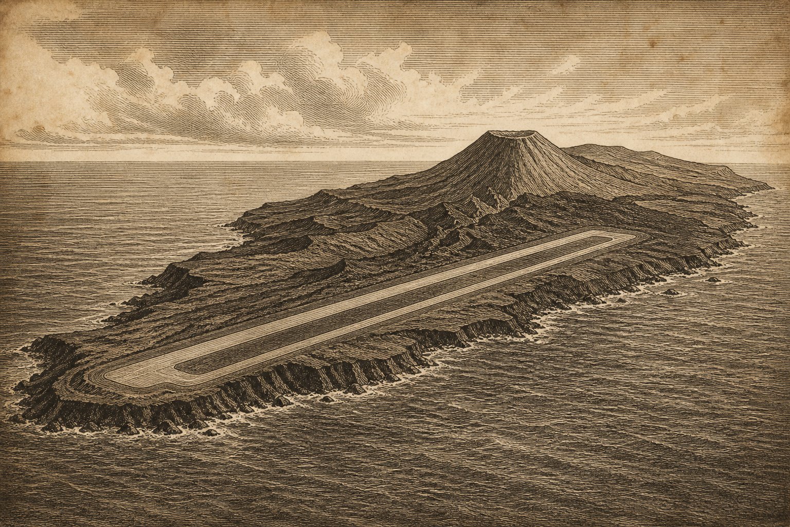
A cone above the Pacific Ocean gives a distant vessel something definite to look toward: land beyond the water, a slope with an edge against the sky. Iwo Jima (Iōtō, 硫黄島) belongs to the Volcano Islands, and its visible ground is only part of a much larger volcano beneath the sea. From offshore, the distinction is difficult to hold in mind. The eye finds the summit, follows the slope, and stops where the water begins. Below that surface, the volcanic structure continues into depths concealed from view. The small outline above the water gives little sense of the ground beneath it.
For someone drawn to far places, Iwo Jima offers the unsettling prospect of land that cannot be treated as fixed, even on a map. Japan administers it as part of Ogasawara Village, Tokyo, approximately 280 km south of Chichijima. The village gives its area as 29.86 km², reflecting an updated map. Those ordinary geographical particulars describe an island where the boundary between land and sea requires renewed attention, and where a familiar name can conceal an unfamiliar physical place.
A cone beyond the water
Mount Suribachi is a volcanic cone containing lava, with a summit known far beyond the surrounding ocean. In February 1945, Joe Rosenthal photographed the American flag raising there. The photograph has a boundary. Beyond its frame lie the slopes below the figures, the rest of the island, and the water around it. Considering the mountain from offshore allows those surroundings into view without diminishing what happened at the summit. The cone stands above a coast with its own physical history, and the sea continues around ground that a single familiar image cannot encompass, however closely that image is remembered.
Another vessel belongs in that wider view. In the late nineteenth century, Tanaka Eijirō sailed from Chichijima aboard Nanyō Maru with companions pursuing shark fishing and sulfur collection. Their purpose was practical: work in these waters and on this volcanic ground. The boat connects the distant outline to people with a particular reason for making the crossing. For a reader following Pacific names such as Agrihan Island, these particulars give the voyage a scale that a general promise of adventure cannot. There is a departure point, a vessel, and the island ahead, with fishing offshore and sulfur to collect on land.
The village that could not return
Sulfur collection became full-scale mining, and Iwo Jima became a place of residence as well as work. Before considering its military history, there is that civilian island to acknowledge: people living on volcanic ground, with the Pacific beyond their shore. The military issued an evacuation order in 1944. Departure became compulsory. The word evacuation can make a community seem briefly present, already in the act of leaving; residence asks for a longer view. This had been a place where people lived, rather than simply an isolated position on a chart or a mountain recognizable from a photograph.
The return of administrative authority to Japan did not make resettlement possible for the former islanders. Severe natural conditions, including volcanic activity, have prevented them from living there again. The obstacle remains physical. For anyone accustomed to imagining a remote island as somewhere to stay, this places a limit on the appeal of distance. A name, an administration, and an enduring connection to a place cannot settle the question of whether it can support a community again. The land remains above the water, but the conditions on that land have kept former residents from reestablishing their lives there.
The coast beyond the chart
At Motoyama, uplifted lava and volcanic material once deposited on the shallow seafloor form part of the island’s ground. A map update in 2023 placed some sections of coastline approximately 800 m farther seaward than on the preceding map. The ground has risen. To consider that change at the shore is to imagine the former waterline inland, with exposed ground between it and the present sea. The difference is large enough to alter the mapped shape of the island. A coast that appears definite from a vessel can occupy a different position when surveyors next establish its outline.
There is movement within the island as well as along its perimeter. Small phreatic explosions have occurred at several locations, including an old crater called the Million Dollar Hole. The name needs no invented history. The crater itself belongs to an active volcanic landscape, where apparently solid ground does not imply the end of volcanic activity. A reader whose interest also reaches Aogashima may pause over the material beneath this island: lava and deposits from the seafloor, raised into land above the water. Underfoot, the rock is part of the same volcano whose greater extent remains submerged beyond the coast.
A runway beside remembered ground
The present island contains a working air base, with Japan Maritime Self-Defense Force and Japan Air Self-Defense Force units stationed there. The base supports emergency medical evacuation from Chichijima, Hahajima, and civilian vessels in surrounding waters. Aircraft serve the living. On the same island, the recovery of Japanese war dead remains unfinished; the number of remains collected is still far below the number killed. These tasks give the present island a human scale beyond its distant outline. Military personnel work here, medical evacuations connect it to other islands and vessels, and the volcano remains under continuous monitoring.
From offshore, the cone can again be considered against the sky, with the rest of the island extending below its summit. For a reader drawn across maps by distant names, there is value in allowing the eye to remain on the whole of it. The mountain has slopes as well as a summit; the land has a shore as well as an outline on paper. Beyond that shore the volcanic ground continues beneath the Pacific, out of sight. Above it, the last visible detail is the edge of the cone against the light.
Quick facts
- Location: Pacific Ocean, Volcano Islands; approximately 24°47′ N, 141°19′ E; about 280 km south of Chichijima.
- Area: About 29.86 km² in the Ogasawara Village figure dated June 2, 2023; substantial uplift and coastline change have expanded the mapped island.
- Highest point: Mount Suribachi, 172 m.
- Status: Administered by Japan as part of Ogasawara Village, Tokyo.
- Population: Japan Maritime Self-Defense Force and Japan Air Self-Defense Force units are stationed on the island; former civilian residents have been unable to resettle because of severe natural conditions.
- Volcanic monitoring: Ioto is listed by the Japan Meteorological Agency as a continuously monitored volcano.
Sources
- Ogasawara Village: 硫黄島 — Iwo Jima
- Ogasawara Village: 概要 — Overview of Iwo Jima
- Ogasawara Village: 歴史 — Historical chronology
- Ogasawara Village: 歴史 — History of Ogasawara
- Geospatial Information Authority of Japan (2023): 拡大する硫黄島の地図を更新!! — Updating the map of expanding Iwo Jima
- Japan Meteorological Agency: 74. Ioto
- Japan Ministry of Defense, Japan Maritime Self-Defense Force (2024): Japan Maritime Self-Defense Force careers brochure: Iwo Jima Air Base profile
- United States National Archives and Records Administration (2024): Photograph of Flag Raising on Iwo Jima, February 23, 1945